
Five new layers have been added to the investment map of Mordovia for business convenience
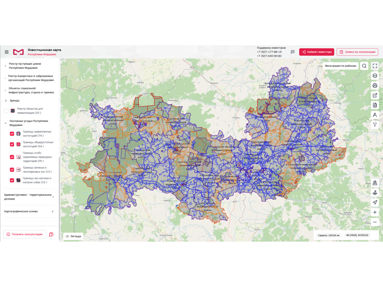
The investment map of the Republic of Mordovia is becoming even more useful for investors. Five new information layers have been added to it. These tools will help to take into account environmental constraints when planning projects.
Map users can now see the boundaries of green and wooded areas. This will help to plan construction taking into account environmental standards. The boundaries of hunting grounds are also accessible, which is important for agricultural and tourism projects. The boundaries of the dog scolding zones will help to avoid conflicts when placing objects. Publicly accessible hunting grounds are marked for the development of recreational infrastructure. Specially protected natural areas (SPNA) have been identified as a key layer for projects related to land use.
The investment map, according to Mordovia Development Corporation, is a living tool that is regularly updated. It helps businesses to assess the prospects of projects in advance, minimize risks, and speed up document approval.
"Creating new layers is another step towards creating a transparent and comfortable environment for investors, - said Andrey Sinitsyn, Deputy Head of the Investment Development Department at the Corporation. - Our goal is that every entrepreneur can quickly get all the necessary information about the territory where he plans to work. The map has already received high marks from experts, and we are not going to stop there".
In the near future, the functionality of the map is planned to be expanded with additional layers, which will make it even more user-friendly.